Whether you are a student considering your first career or someone already in the workplace who is considering a new career, choosing GIS can be rewarding in many ways. The growth potential in this sector has remained high. As GIS and other geospatial technologies expand, it offers opportunities for people with different work experiences and educational backgrounds.
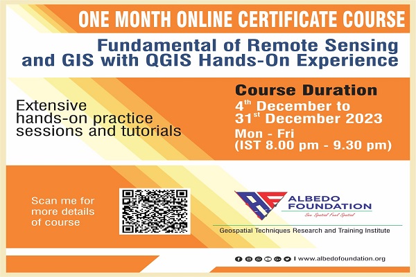
This course will boost your confidence in GIS and handling QGIS software efficiently. GIS depends on data collected in the field. Your "field" could be atop a glacier, in a river, on a city street. There is no end to what needs to be mapped and analyzed. This course will guide you right from georeferencing the dataset to the end visualization results as a map.
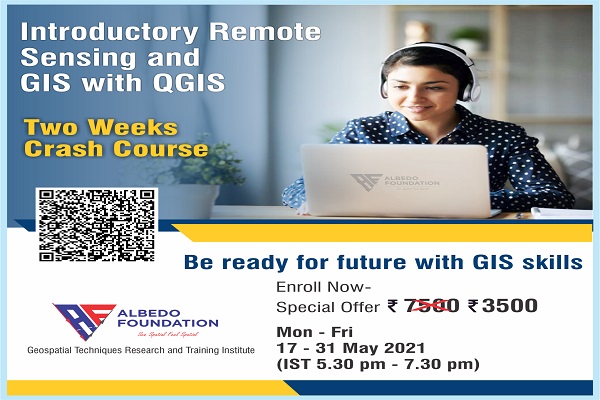
This is a weekdays course of a total of 30 hours with hands-on training and assignments. The credits will be given according to attendance during the course work and performance during the hands-on and assignment submissions along with the score in the online quiz during the entire course work. Minimum 50% credits are required to avail of the online course e-certificate to strengthen your resume at various levels.
Monday to Friday (5.30 pm to 7.30 pm)
What You Will Learn in the course:
Know our course instructor
Vikrant Nikam
He has pursued his M.Tech in Remote Sensing and GIS from the Indian Institute of Remote Sensing (IIRS, ISRO) and he is a well-known and reputed educator of GIS for the last 2 years.
Prerequisite
For whom
Maximum Seats are 10 only... Register Now!
I had been looking for courses related to QGIS as I had a hard time getting started with the application. I am glad I came across this crash course. Sir is an excellent teacher. He explains everything elaborately and consistently asks questions to keep you hooked on the topic. The class is minimal, which gives us plenty of time to ask doubts answered in a very crisp and patient manner. Overall, I really enjoyed the course and would recommend it to anyone who would like to be introduced to
Garima Bora
This is the first time I have attended a class in an online format and wondered how effective it would be. It was very effective, and therefore I would definitely be interested in attending other classes in the same format with the Albedo Foundation. The instructor was very knowledgeable and provided a wealth of information about Remote sensing and QGIS. It was an informative course, and I learned something new apart from regular subjects. Thank you, Albedo Foundation, for such an amazing
Shweta Aher
Being civil background student, I decided to learn GIS concepts, and for that, I look for an appropriate institution; finally, I found the Albedo Foundation. I joined a short-term course of remote sensing and gis with QGIS software and join with zero knowledge of that, but the lecturer Vikrant sir's systematic teaching approach, practices, and assignments make me learn QGIS basics. And with using that, I hope I can do gis projects confidently.
Manoj Kumar
Developed by Collabx